NOTE: This unit is geared towards 1st and 2nd grade students. But could easily be adapted for younger or older students.
Norte, Oeste, Este, Sur Game
I taught the cardinal and direction points in Spanish (or puntos cardinales.) I used a large map I drew (pretty badly) of the United States, Mexico, Guatemala, and Belize.

We discussed how a map is 2 dimensional and a globe is three dimensional and how to use a compass. Then I played a game. I call it the compass game. I sit in the center of the classroom and I am the compass. There are labels on each of the four sides of the classroom labeled Norte, Oeste, Este, and Sur. I would close my eyes and students would get a chance to go to whatever side of the room they choose. As the compass I would then point to a side and say it aloud as I opened my eyes. The students who were in that area of the room were out of the game. We kept playing until only a handful of students were still in the game. The students who were out were responsible for repeating "Adónde vas?" 8 times as their classmates chose a side. Here is crude picture to explain further the layout of the game:
 |
| Teacher in the center is the compass. Students (orange dots) have to try to guess where the teacher will NOT point. |
Worksheets
Here are two worksheets that my students completed in relation to the geography of Mexico. Word searches are easy to design specific to the vocabulary you teach in your class. Check out Armored Penguin to make your own.

I also had a worksheet for students to complete that focused on writing the terms Norte, Oeste, Este, Sur and identifying the capital of Mexico.

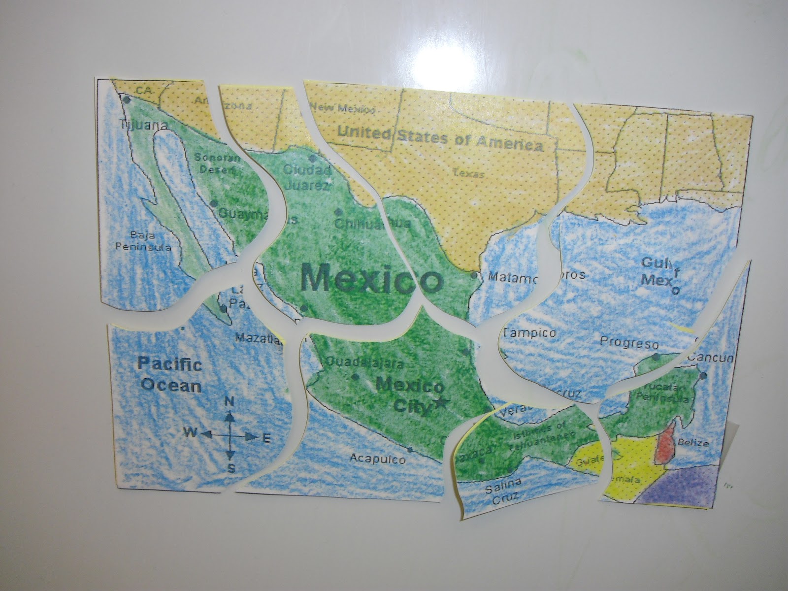
Make your own Mexican Map Puzzles
Students created their own puzzles of the map of Mexico. They are really easy to make. All you have to do is take a blank map of Mexico. If you want a detailed map of Mexico check out Enchanted Learning. Here is a good blank map of Mexico:

 Then cut out the map (the size should be the size of an index card.)
 Next, have students glue the cut out on an index card. You could then laminate to make it studier, but this is not necessary. I also used different color index cards so that students could remember to try a puzzle that is different than the one they made.

Then have students cut the map out in to different sized pieces. Try to lower the number of pieces depending on how old the students are (Kindergarten 5-8 pieces, 1st grade 8-10 pieces, 2nd grade 10-15 pieces.) Try to avoid them cutting tiny pieces because they easily can get lost.
 Then place the pieces in a bag for students to swap. I kept the puzzles as a center in my classroom. If you would like students to take them home, make sure to have student's names on the bags.

Here are two worksheets that my students completed in relation to the geography of Mexico. Word searches are easy to design specific to the vocabulary you teach in your class. Check out Armored Penguin to make your own.


Make your own Mexican Map Puzzles
Students created their own puzzles of the map of Mexico. They are really easy to make. All you have to do is take a blank map of Mexico. If you want a detailed map of Mexico check out Enchanted Learning. Here is a good blank map of Mexico:

Whichever map you choose, have students color in the maps completely.


Then have students cut the map out in to different sized pieces. Try to lower the number of pieces depending on how old the students are (Kindergarten 5-8 pieces, 1st grade 8-10 pieces, 2nd grade 10-15 pieces.) Try to avoid them cutting tiny pieces because they easily can get lost.